


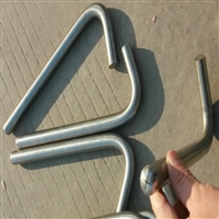


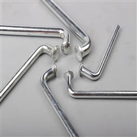
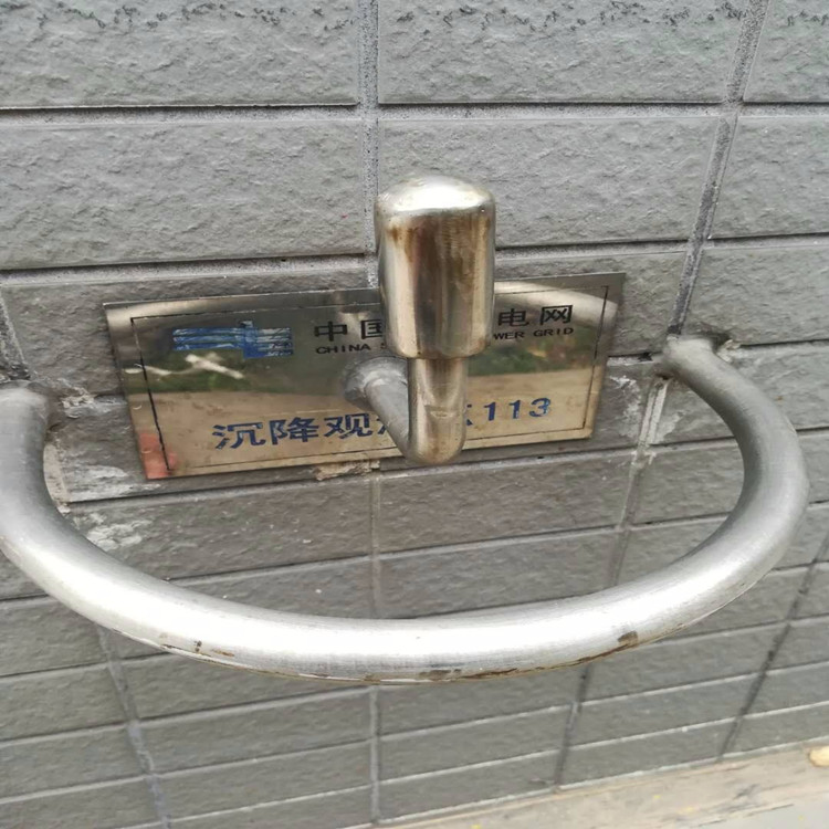
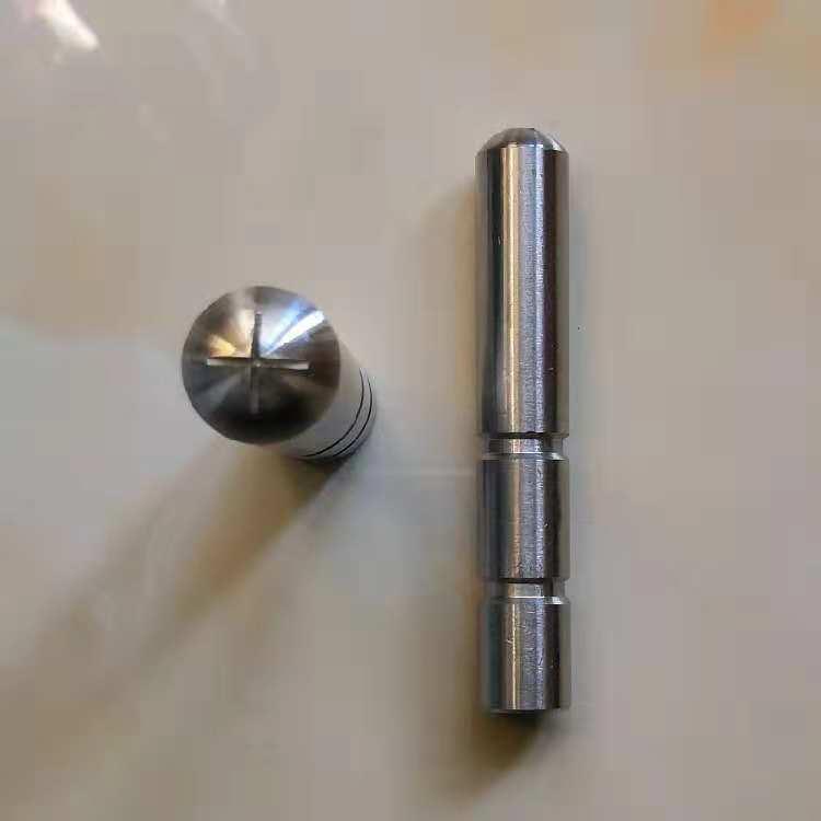
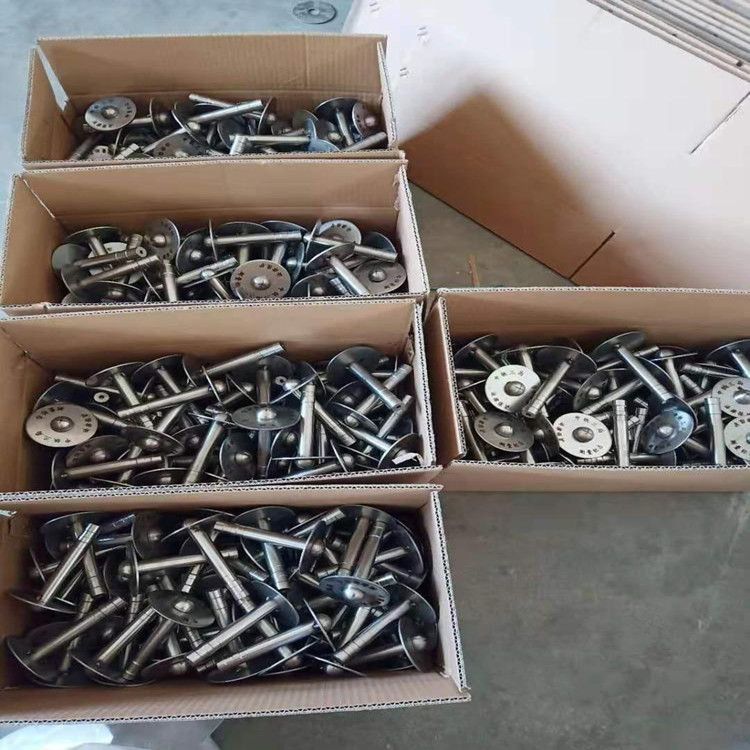
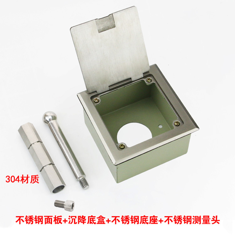
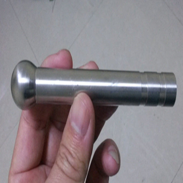
Customized wholesale and retail of Nanyang observation standard L-type 304 stainless steel observation standard
Category:
metallurgy/Stainless steel material/Stainless steel bars
Model:
Brand:
Cangzhou Shuntian
grade:
Observation standard
cross-sectional shape:
round bar
surface treatment:
glossy surface
Processing Technology:
Forging
tensile strength:
370MPa~480MPa
Processing Service:
deep processing
execution standard:
National Standard
quality grade:
A-level
Processing & Customization:
yes
Is it imported:
No
weight:
one
Scope of application:
rail transit
delivery service:
Can be delivered to the factory
Type of goods sales:
spot
Item Number:
twenty thousand one hundred and twenty
warehouse address:
Cangzhou, Hebei
warehouse phone:
fifteen billion one hundred and three million three hundred and seventy-two thousand six hundred and sixty-seven
manufacturer:
Cangzhou Shuntian Steel Pipe Co., Ltd
Retail Price
12.00USD
重量
kg
- Product Description
-
grade Observation standard
cross-sectional shape round bar
surface treatment glossy surface
Processing Technology Forging
tensile strength 370MPa~480MPa
Processing Service deep processing
execution standard National Standard
quality grade A-level
Processing & Customization yes
Is it imported No
weight one
Scope of application rail transit
delivery service Can be delivered to the factory
Type of goods sales spot
Item Number twenty thousand one hundred and twenty
warehouse address Cangzhou, Hebei
warehouse phone fifteen billion one hundred and three million three hundred and seventy-two thousand six hundred and sixty-seven
manufacturer Cangzhou Shuntian Steel Pipe Co., Ltd
Description :
Customized wholesale and retail of Nanyang observation standard L-type 304 stainless steel observation standard
Arrangement method of observation points
Observation points should be arranged at the boundaries of mapping units, lithological and lithological changes, fault lines, fold axes, marker layers, important fossil points, ore bearing layers and mineralized outcrops, joint and foliation measurement and statistics offices, well springs, important sample collection sites, and other meaningful geological phenomena (such as landforms, adverse geological processes, cultural relics excavation sites, etc.).
According to the function of observation points, they can be divided into control points and descriptive points. Control points are lithological observation points arranged to control mapping units with exposed widths greater than the spacing between geological points. They mainly record point locations, point characteristics, detailed and accurate rock names, special structures, and structural features. The description points are arranged at important or typical geological phenomena, such as unconformities, intrusive contacts, important top and bottom structures, facies markers, fold axes, faults, etc. The interface (line) exposed points should be observed, studied, described, recorded, sampled, sketched, and photographed in detail.

The spacing between observation points should be based on task requirements, in order to effectively control and collect sufficient geological, structural, mineral, and other geological data to meet the requirements for mapping and report writing. All mapping units (formal and informal stratigraphic units), fault lines, fold axes, and other important geological phenomena should have sufficient observation points for control. Generally arranged according to the mapping scale, the point spacing on various geological boundaries is about 1 cm on the map (1:50000 point spacing is about 500m), but for large areas of Quaternary distribution with a single genetic type and age, the point spacing (and line spacing) can be reduced by about twice. Geological bodies with a distance equal to or greater than the route spacing, and closed geological bodies with a distance greater than lcm on the map should be controlled by at least two observation points.
Due to the deployment of monitoring areas mostly in mountainous and wilderness areas, there are many layout restrictions on power and communication networks. The number of sensors connected through wired connections is limited, and wiring is difficult, making it unsuitable for geological environments with complex terrain and multiple monitoring points. Wireless tilt sensors can automatically supply power and perform digital to analog conversion without wiring, making installation simpler and greatly reducing maintenance costs. There is no direct electrical connection between them, and there is no problem of mutual interference.
Wireless tilt sensors send data information through wireless gateways, earth stations, broadband networks, etc. Sensor nodes all have routing functions, and they form a network with base station nodes in a hierarchical and autonomous manner to achieve long-distance communication. Sensors collect data on the deformation and displacement of structures, and after obtaining data from each sensor, it is processed through data fusion and finally reaches the monitoring center. Monitoring personnel can remotely obtain the trend and intensity of mountain deformation, judge its threat level, and provide timely warning information for nearby residents, passing vehicles, etc.
More than two-thirds of the total area in China is mountainous, and currently, wireless tilt sensors have been applied to monitor mountain structures in multiple locations. The development of modern IoT sensing technology has promoted the research and application of more new intelligent monitoring products, and our early warning of disasters has become increasingly comprehensive, automated, and controllable.
AfterSalesService :
Key words:- Nanyang Observation Standard
More Products


